Vermont's Independent Voice
Browse News


Browse Arts + Culture


Browse Food + Drink


Browse Cannabis


Browse Music


Browse On Screen


Browse Events


Browse Classifieds
Browse Personals

Published December 12, 2006 at 10:59 p.m.
» Watch a short video interview.
Urban Woodbury was a former mayor of Burlington who went on to become the 45th governor of Vermont. He grew up in Wolcott, near Lake Elmore, at the intersection of two country roads that no longer exist. The exact spot, now thoroughly overgrown, is currently uncharted. That presents a unique challenge for cartographer David Allen. The 56-year-old New Hampshire resident is Woodbury's great-great-grandson. He's also the purveyor of old Vermont maps that he believes will help him locate his ancestor's homestead.
Spend a morning with Allen and you realize how much we take maps for granted. Nowadays you punch an address into Google, and within seconds you've got a street map and a satellite photo. But as Allen is eager to observe, maps haven't always been so accessible. In fact, there were few of any kind in 19th-century Vermont.
Back then, to print an image, it would have to be engraved backwards on a copper plate - a difficult and expensive process. Allen says there simply wasn't a local market for maps made that way, and the government wasn't going to spring for them. "They'd map the coast for warfare," he says, "but not Stowe."
That changed in the 1850s, with the advent of a form of positive lithography. Businessmen from Philadelphia and New York traveled here to take measurements for 11, 5-foot-square wall maps, the first mass-produced maps of Vermont. Allen estimates that anywhere from several hundred to 1000 copies of each were made. Those that have survived are in museums and private collections, and haven't been widely available to the public in years.
Allen's trying to change that by resurrecting old maps of New England. In the 1970s, he tried to reprint the early Vermont maps, but with little success. "I reproduced some of these things on paper and lost my shirt," he confides. In 2004, Allen, who owns his own land-surveying company, began scanning and digitizing them. For the past year, he's been hawking them on CD-ROM for $30 apiece, or $300 for the full set. They're now available at local bookstores and on Allen's website, www.old-maps.com.
You wouldn't use one of these elegantly scripted gems to find your way around - many of the roads and dwellings they depict have long since disappeared. But that doesn't mean they're useless. Because they list landowners' names, they can be used to chart demographic changes in the region over time, or to find old roads or family homesteads.
Allen recently discovered that his great-great-great-grandfather, Albert M. Woodbury, owned land just north of Lake Elmore, in Wolcott. He found Wood- bury's name next to a black dot on the 1859 map of Orleans, Lamoille and Essex counties. On an unseasonably warm day in late November, Allen and I set out to find it.
Before our trek, he prints out a section of the map to use as a guide. In addition, he prints the relevant sections of the 1878 Beers Atlas, and the 1930s U.S. Geological Survey map of the area, which he's also digitized and offers for sale. Yet another reference is human: Wolcott's 80-year-old town lister, Arlo Sterner, has agreed to aid in the search.
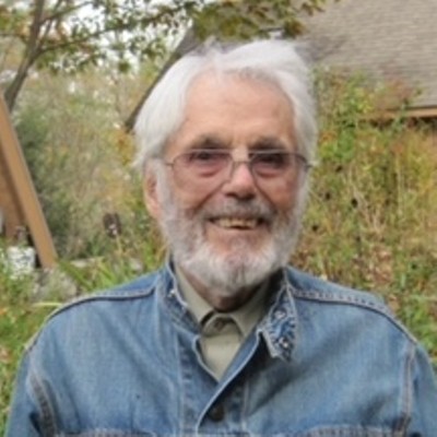
The three of us meet on a Thursday morning over coffee at the Bee's Knees Café in Morrisville. Allen is a bearded, bespectacled fellow who studied political science, and protested the Vietnam War, at the University of Vermont in the early 1970s. Sterner is a registered land surveyor who wears a Wolcott Volunteer Fire Department cap and carries a tin of Redman. This odd couple had already ventured out once to find the house - unsuccessfully.
The 1859 map clearly shows the Woodbury residence where two country roads cross, but those roads no longer exist. The only way to find it now is to stumble around in the woods near where it must have been. That's what Allen and Sterner did the first time, but now Sterner wants to try something different. After a brief chat, he hops in his pick-up truck and we follow him in our own cars to Lake Elmore. There, Sterner turns down a road that leads to a dirt road, and to the house of his friend Larry Demar.
We park on Demar's land, near a truck piled high with Christmas trees - he and his wife have been selling them for the past 26 years in Manhattan, and are leaving this afternoon. We're lucky to catch them. Sterner says he thinks Demar can show us the Woodbury homestead. "He's a local redneck that has an idea where things are because he snoops," he explains wryly. It helps that Demar's family has been here for generations - at one point they owned the Woodbury land.
Demar, a bearded, barrel-chested man with a pronounced Vermont accent, looks at the printout of the 1859 map and says he knows where to find the house. He takes a break from working on a truck to lead us there. He and his wife Linda accompany our group through the brush, along with Sterner's mutt Little Bit. After a short walk, we come to a long, narrow, leaf-covered cut in the land that looks like a ditch.
"You see this cavity?" asks Demar. "That's the old county road. We used to travel that. The old cattle trucks used to travel that."
We pick our way down the old roadbed, walking through chest-high weeds and brambles, until we come to a gravel road running perpendicular to our path. We cross that and continue through the brush, until Demar lets out a shout.
What he's found is a 25-by-30-foot cellar hole about 7 feet deep. It's lined with moss-covered stones and filled with branches, leaves and an assortment of old junk, including countless tires, the hulking remains of a furnace, and a rusting can of fly pesticide called "C-Em-Die." Welcome to the childhood home of Vermont's 45th governor.
Demar remembers the house that was once here - "a nice two-story house with an attic," he says. He and his family tried to haul it up the hill in the 1940s, but a bolt came loose in the contraption they rigged to move it, and the house was ruined.
It doesn't seem to matter to Allen. He's ecstatic over the find. He climbs into the hole and snaps pictures with his digital camera. "This has been quite the adventure," he declares contentedly.
Larry and Linda Demar head back up to their house while Allen and Sterner continue to search for the Woodbury barn. After a few minutes, Sterner calls out, "David, I found the barn."
This site isn't as exciting; it's just a large open spot on a small rise behind the house. It's hard to compete with the crap-filled cellar.
After poking around for a while longer, we stroll back up the gravel road. On the way, Allen and Sterner explain how the first profiteering mapmakers charted this terrain, not all of it 100 percent accurately. "They were just driving down the road in their buggy with a compass and an odometer; They weren't being terribly careful," Allen admits. "Their main purpose was to generally show the roads, and show all the houses."
The men who made the maps were also often selling them. "Can you imagine an old country road," he says - "you have maybe one person go by a day, and along comes this contraption with a great big wheel on it and some kind of a counting device on top of the wheel to count the clicks."
He imagines a conversation between the farmer and the mapmaker. "'What are you doing?' 'Well I'm making a map,' And the guy then gets out his little sales package and tells the farmer, 'Your name's going to be on this map, and if you give us five bucks, you can get a copy.' We're fairly sure that's how it was done," Allen says.
"You think back to those people who were making these old maps," he muses. "They thought they had the smartest, latest and greatest technology, but they didn't have a clue what was coming."
Clearly, Allen appreciates advances in technology. It's computers, after all, that make it possible for him to distribute these old maps. But he also laments that people today are "findable" at all times. "I have this terrible feeling that, the next generation, we're all going to have little chips embedded in us," he suggests, "and we're just going to know exactly where we are by controlling satellites from the skies."
Is that progress? Maybe. But I get the sense Allen would resist - he'd rather be poking around in the woods with good old boys and good old maps.
More By This Author


About The Author

Cathy Resmer
Bio:
Deputy publisher Cathy Resmer is an organizer of the Vermont Tech Jam. She also oversees Seven Days' parenting publication, Kids VT, and created the Good Citizen Challenge, a youth civics initiative. Resmer began her career at Seven Days as a freelance writer in 2001. Hired as a staff writer in 2005, she became the publication's first online editor in 2007.
Deputy publisher Cathy Resmer is an organizer of the Vermont Tech Jam. She also oversees Seven Days' parenting publication, Kids VT, and created the Good Citizen Challenge, a youth civics initiative. Resmer began her career at Seven Days as a freelance writer in 2001. Hired as a staff writer in 2005, she became the publication's first online editor in 2007.
Speaking of Local Issues
-

At the Junction of State and Federal Law, I-91 Checkpoint Becomes Site of Legal Collision
Feb 5, 2014 -

Maple Makeover? Vermonters Discover a New Sugaring Technique
Feb 5, 2014 -

Disharmony on Prospect Street: A Dispute Between Neighbors Strikes a Sour Note
Feb 5, 2014 -

Treatment or Trial? Growing 'Rapid-Intervention' Program Gives Addicted Offenders a Choice
Jan 29, 2014 -

Raw Deal? Farmers Push Back Against Unpasteurized Milk Regulations
Jan 29, 2014 - More »
Comments
Comments are closed.
From 2014-2020, Seven Days allowed readers to comment on all stories posted on our website. While we've appreciated the suggestions and insights, right now Seven Days is prioritizing our core mission — producing high-quality, responsible local journalism — over moderating online debates between readers.
To criticize, correct or praise our reporting, please send us a letter to the editor or send us a tip. We’ll check it out and report the results.
Online comments may return when we have better tech tools for managing them. Thanks for reading.